
Angler's Guide to Chuaga River Trout Fishing Map

If you're planning a fly fishing trip in South Carolina, getting familiar with the Chauga River trout fishing map is a must. Whether you're a local angler or visiting for the weekend, knowing where to access the river, what trout waters are most productive, and how to read the river's structure can make or break your day on the water. The Chauga River is gaining popularity among fly fishers for its scenic access points and healthy trout populations—but success here depends on smart planning. In this post, we’ll break down what makes the Chauga a go-to destination, explain how to use a trout fishing map effectively, and walk through seasonal tips, fly recommendations, and safety best practices. Whether you’re new to the area or returning for another round, this guide will help you get the most out of your time on the water.
Understanding the Chauga River Trout Fishing Map
What to Expect from a Good Fishing Map
A solid trout fishing map of the Chauga River should offer more than just a visual of the river’s path. The best maps identify public access points, trailheads, parking areas, and boundary lines between public and private land. They’ll also mark key features like riffles, runs, pools, and holding water where trout are likely to stage. Look for versions—digital or printed—that include GPS coordinates, contour lines, and updated trail access. Some enhanced maps also show stocked versus wild trout zones, which is helpful when choosing your strategy. A detailed map saves time and helps avoid trespassing issues.
Key Sections of the River for Trout
The Chauga River offers a diverse stretch of trout water flowing through the Sumter National Forest. The upper sections are tight and brushy, ideal for short casts and dry flies in pocket water. Mid-river reaches have more open flow with deeper pools, making them suitable for nymphing and streamer work. Downstream, the river slows in places and widens slightly, where stealth and light tippet are key. The delayed harvest section near Cassidy Bridge is especially popular due to its catch-and-release rules and consistent trout population. A good map will label these sections so you can match your gear and tactics to the water.
Notable Access Points and Parking Locations
The Chauga River has multiple access points, each offering a slightly different fishing experience. Using a fishing map—and pairing it with satellite or topographic view—can help you locate entry points, plan your hike or wade, and avoid trespassing. Below are the primary public access points along with suggestions on where to embed Google Maps for reader convenience.
Cassidy Bridge Access (Delayed Harvest Section)
The most popular access point is at Cassidy Bridge, which offers direct entry into the Delayed Harvest section of the Chauga. Anglers will find an easy pull-off area with parking near the bridge and multiple trails leading down to the water. This is a great spot for both wading and walking upstream or downstream to explore productive pools.
Verner Mill Road Access
Verner Mill Road provides lesser-known but quality access for anglers who don’t mind a bit of walking. This area isn’t as crowded and is ideal for anglers looking to fish quietly or explore upstream sections with tighter cover.
FS Road 744 (Forest Service Access)
Forest Service Road 744 leads to walk-in trails that give anglers access to less-pressured stretches of the Chauga. While more remote, it’s worth the effort for those who want solitude or to reach water with minimal fishing pressure.
Regulations You Need to Know (Seasons, Limits, etc.)
The Chauga River is managed under a mix of general and special trout regulations. The delayed harvest section—from Cassidy Bridge Upstream to Grapevine is strictly catch-and-release from November 1 through May 14th, with artificial lures and single-hook regulations in effect. Outside of that window, harvest is allowed within posted limits. Other parts of the river fall under standard South Carolina trout rules. A reliable fishing map should note these regulation changes and highlight boundaries between different management zones. Always cross-reference with South Carolina DNR to stay current, but a well-marked map helps keep you on the right side of the law while protecting this quality fishery.
Tips for Using a Trout Fishing Map Effectively
Reading the River’s Structure (Pools, Riffles, Runs)
One of the most useful aspects of a trout fishing map is identifying where fish are likely to hold. On the Chauga River, understanding river structure helps you zero in on productive water quickly. Use the map to spot deep pools, which often hold trout during midday or in colder months. Riffles are shallower, oxygen-rich zones where trout feed, especially during hatches. Runs connect pools and riffles and often have moderate depth and current, making them reliable feeding lanes. When studying a map, look for changes in elevation and contour lines that hint at transitions between these types of water. If your map includes aerial or satellite imagery, you can even identify large rocks, log jams, and cut banks—great holding spots for trout.
Using Satellite and Topo Map Layers
Many online fishing maps (like Google Earth or MyTopo) allow you to toggle between different layers—satellite, terrain, and topographic views. Topo maps are especially helpful for reading elevation change and figuring out how steep or flat an approach might be. This is useful when planning hikes into remote sections of the Chauga River or identifying areas where steep canyon walls might block access. Satellite view helps with locating landmarks like parking pull-offs, clearings, and trails to the water. Combining both views can give you a full picture of the river’s surroundings and help plan efficient access. It also helps you determine where cell service might drop off, so you can prepare in advance if using mobile navigation tools.
Planning a Productive Float or Wading Route
Whether you’re walking a mile or floating a stretch of the Chauga, using your map to plan the route will maximize your time fishing. Start by marking your entry and exit points. Then use the map to identify target zones—long runs, deep pools, or high-structure areas—where you’ll spend more time. If you’re wading, look for stretches where you can safely enter and exit without crossing private land. For floats, make note of any shallow gravel bars, strainers, or pinch points that could affect safety. Maps can also help you estimate how long a section will take to cover based on river gradient and structure. Having a planned route lets you spend more time fishing and less time backtracking or figuring out your next move.
Safety, Etiquette, and Conservation
Proper Catch-and-Release Practices
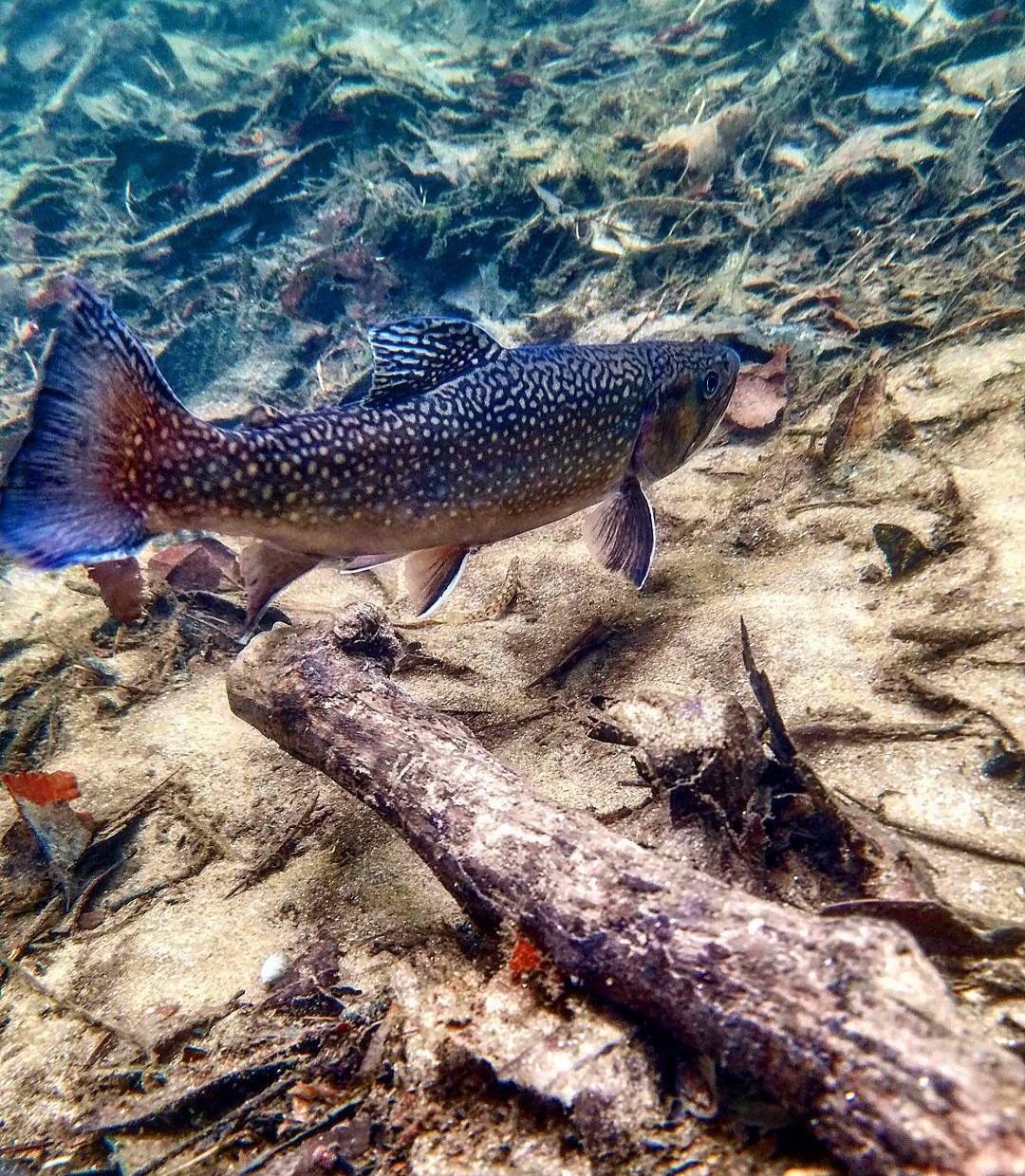
When fishing the Chauga River, especially in the Delayed Harvest section, practicing proper catch-and-release techniques is critical to protecting the trout population. Always use barbless hooks or crimp the barb before fishing. Wet your hands before handling fish to protect their slime layer, and avoid squeezing them or letting them flop on dry rocks. Keep the fish in the water as much as possible during hook removal. If you want a photo, have your camera ready and minimize air exposure to just a few seconds. Support the fish gently, head facing upstream, until it kicks away on its own. These small actions make a big difference in trout survival rates, especially during warmer months when oxygen levels in the water drop.
How to Stay Safe on Remote Sections
The Chauga River flows through some rugged terrain, especially in the national forest areas. Always let someone know where you’ll be fishing and when you expect to return. Cell service is spotty in many areas, so consider using a GPS tracker or offline maps on your phone. Wear proper wading gear, including a belt to keep water from filling your waders if you fall. A wading staff can help you navigate slippery rocks and fast-moving current. Weather changes quickly in this region, so check the forecast and bring layers, rain gear, and plenty of water. Carry a small first aid kit and have a plan for emergencies. Even on a day trip, preparedness can make all the difference if something goes wrong.
Stream Etiquette: Sharing the Water
Fly fishing etiquette matters just as much as skill when it comes to enjoying your time on the Chauga. Give other anglers plenty of space—at least two full casts’ distance—and never crowd someone already working a section. If you’re hiking in and see someone downstream, ask before jumping in nearby. On smaller rivers like the Chauga, most anglers work upstream, so try to approach from behind and avoid stirring up sediment. If you’re floating, steer wide around wading anglers and avoid anchoring in popular wade spots. Pick up any trash you see, including old tippet and fly packaging, and leave the water cleaner than you found it. A little courtesy goes a long way toward keeping this fishery enjoyable for everyone.

Additional Resources for Planning Your Trip
Where to Get a Reliable Chauga River Trout Fishing Map
To fish the Chauga River confidently, start with a reliable map that marks access points, river features, and regulation zones. South Carolina Department of Natural Resources (SCDNR) is a solid source, offering printed maps and online resources. You can also use platforms like Gaia GPS, OnX Hunt, or Google My Maps to build custom overlays with access points and fishing notes. Local fly shops near Walhalla or Mountain Rest often carry hard-copy maps and can point out updates not yet reflected online. If you prefer mobile apps, check that your map of choice allows offline access—cell coverage is limited along much of the river. A high-quality map saves time and keeps you fishing legal waters.
Fly Shops and Local Guides Near the River
Tapping into local knowledge can elevate your trip. Shops like Chattooga River Fly Shop in Mountain Rest carry flies that match current hatches and offer up-to-date river reports. They’re also good sources for gear rentals, licenses, and stream conditions. If you’re new to the Chauga or want to cover more water, hiring a guide is a smart move. Local guides are familiar with water levels, fish behavior, and seasonal fly choices. Many also teach casting and wading techniques specific to this type of river. Booking a guide is especially helpful if you’re short on time and want to make the most of a day on the water.
Apps and Digital Tools That Help on the Water
There are several tools that can make fishing the Chauga more efficient and productive. Fishbrain and Anglr allow you to track catches, mark GPS locations, and log fly patterns. For river flow and water conditions, check the USGS stream gauge near Long Creek, which shows current CFS levels and helps determine safe wading conditions. Weather apps like Windy or AccuWeather are great for spotting approaching storms or temperature swings that could affect trout activity. Offline GPS apps like Gaia or Avenza Maps are especially useful in areas with no cell service. By combining these tools, you can plan smarter, adjust faster, and fish more effectively.
Frequently Asked Questions
Is the Chauga River good for beginners?
Yes, the Chauga River is a solid choice for beginners, especially the Delayed Harvest section near Cassidy Bridge. It’s stocked, easy to access, and the moderate flow makes wading manageable. This section also has fewer casting obstacles and clear pools where new anglers can practice presentation. Local fly shops often provide beginner-friendly gear and tips tailored to this river.
Can I camp along the river?
You can camp in parts of Sumter National Forest along the Chauga River, as long as you follow Leave No Trace guidelines and stay at least 50 feet from the water. Cherry Hill Campground is a popular nearby option with basic amenities. Cell service is limited, so bring a physical map and check current forest service regulations before your trip.
What’s the best month to fish the Chauga?
The best months are April, May, October, and November. Spring and fall offer cool water, active trout, and steady insect hatches. The Delayed Harvest season (Nov–mid-May) is especially productive. Summer can be tougher due to warm water, but early mornings or higher-elevation stretches still offer some opportunities.
Plan Your Trip with Crooked Feather Outfitters
The Chauga River offers a mix of accessibility, scenic beauty, and productive trout water that makes it a standout destination for anglers of all levels. From understanding how to use a detailed fishing map to navigating access points, reading river structure, and following catch-and-release best practices, planning ahead can make your day on the water more successful and enjoyable. Whether you're targeting stocked trout in the Delayed Harvest section or exploring remote runs upstream, knowing where and how to fish is key.
Ready to put this knowledge to use? Book a guided trip with Crooked Feather Outfitters. Our experienced team knows the Chauga inside and out and can help you get on fish faster, whether you’re new to fly fishing or just looking to explore new water. Let us handle the details—so you can focus on the cast.

About The Author | Aaron Becker
Aaron was born in Maine, and got into fishing at a young age. You could say that the outdoors is his second home. Fly fishing has always been his deep love and passion and he spends every day dreaming about the next time he’ll be in the river. Aaron has spent decades honing his skills to be the best at what he does. Aaron, a graduate from the Gallatin River Guide School in Montana, has a wealth of knowledge. He’s fished all over the country for a variety of species. The last decade, Aaron has spent hundreds of days each year on the water in South Carolina. His knowledge of the area is top notch and he is there to share it with beginners and experienced anglers alike. So, if you’re looking for a guide with decades of knowledge of fly fishing and extensive experience in South Carolina he’s the guide you want.